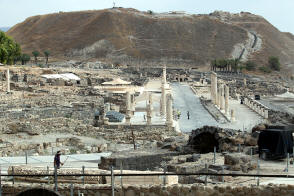
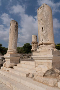
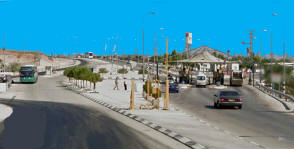
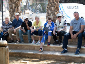
Thursday, September 12. Our bus left the hotel at 8:15 after the buffet breakfast. We headed south, retracing the previous day’s route to Yardenit. A few miles south of that, the highway crossed the Jordan on a small concrete bridge. Just south of that, the Marmouk River joins the Jordan from the east. From that point south the Jordan River forms the boundary between Israel and the Kingdom of Jordan. About 9:15, we arrived at the excavated site of Beit She’an. There had been many different settlements here. Excavations (beginning in 1921) revealed 18 successive ancient towns, going all the way back to about 5,000 B.C. The ruins we saw were from the city built by the Romans after their annexation of Judea in 63 B.C. We entered the site on the southeast side and had a great view up the colonnaded main street (cardo). several of the main buildings had stood along this street, including the bath houses (now restored), the temple, the basilica, and at the far end, the fountain. The huge Tell Beit She'an (still unexcavated) loomed in the background. Just to our right was the theater. Given an hour to explore, we visited the theater, considered the best preserved of any from ancient Samaria,To demonstrate the fine acoustics, Taylor Keller sang “If I were a rich man” from “Fiddler on the Roof”. (He has a great voice.) . We also walked among the Roman gates and columns. Our bus left at 10:15 as we continued south to Jericho.
Several miles south of Beit She”an, we passed from Israel into the West Bank for the first time.
The highway widened slightly and there was a check point on each side. There was little traffic
and we were through in a few seconds. Everything around us looked just the same as it had on the
other side. Shanee took this opportunity to explain the situation in the West Bank. The Oslo accords set up three West Bank zones: - Zone A where the Palestinian Authority is responsible for internal security and public order. This Zone includes eight large West Bank cities. - Zone B where Palestinian police maintain order, but Israel retains overriding authority for security. This Zone includes other West Bank towns and villages. - Zone C where Israel retains full security authority. This Zone includes Jewish settlements, unpopulated areas, and any other lands Israel views as strategic. The area of the West Bank that we had just entered, being mostly unpopulated, was Zone C, but about 11:30 we arrived in Jericho, Zone A. This is one of the oldest inhabited cities in the world, as well as the city with the oldest known protective wall. Archaeologists have unearthed the remains of more than 20 successive settlements in Jericho, the first dating back to 9000 B.C. At 825 feet below sea level, it is also the lowest city in the world. We did not actually go into the urban area of Jericho. Our bus pulled into a parking area along the highway for lunch. On one side of the lot was Elija’s Spring where the prophet is said to have purified the nonpotable water by throwing salt into the spring. The water was flowing freelu, and most of us sampled it. Towering over the parking lot was Mount Quarantine, generally identified as the Mount of Temptation, where Jesus was tempted by the devil. Halfway up the mountainside was the Greek Orthodox Monastery of the Temptation. There were also camel rides for tourists in the parking lot, as well as the Temptation Restaurant “with the largest food buffet in the Holy Land,” where we had lunch. Our bus left Jericho at 12;40 and turned west on the highway to Jerusalem. Unlike our drive from Galilee to Jericho that was mostly straight and flat, this stretch was very curvy and hilly. The road climbs about 3,000 feet in the 16 miles to Jerusalem, but there are many ups and down s along the way. There were a few scattered settlements, some modern (Israel) and others old and rundown (Palestinian). This was a dangerous road in ancient times and is where the Good Samaritan helped the traveler beset by robbers. There are some tourist sites (e.g., hotel; museum) along the road exploiting the parable. | ||


