|
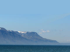
ICELAND Monday, 17 September. This was a day at sea, and we were happy to have a free day after the last three busy days. After breakfast in the Horizon Court, we went to an hour lecture on Reykjavik at 10:00. The seas were rough all day and the ship was running late. We got in a lot of reading, and I got to the gym in the afternoon. Dinner was formal this evening, and at 9:15 we went to the Explorer Lounge to see a male vocalist/impressionist. At bedtime, we set our clocks back an hour (2nd of 6). Tuesday, 18 September. The seas were not as rough anymore when we got up about 7:40. (Remember, we'd gained an hour during the night.) We had a leisurely breakfast in the DaVinci dining room. A little after 11:00 we spotted Iceland. As we approached Reykjavik, we could see snow on Mt. Esja, flanking the harbor. The ship docked about 12:45. It was nice and sunny with temperatures in the forties. We had pizza for lunch on the Lido deck just outside our room. Afterwards the weather was pleasant enough for us to sit on our balcony for an hour before leaving for our shore excursion.
Our tour bus left at 2:40. The weather
was sunny and mild all day, well into the 50s. Just
outside the harbor, our guide pointed out the Viking
Restaurant, built and decorated to fit its theme. As the
bus drove us around the downtown area, I was surprised
to see a sizable lake right in the center of the city.
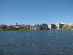
This was Lake Tjornin. The Parliament (Althing) building
(1881) and the Cathedral (Lutheran) (1879) stood side by
side at the near end of the lake. The City Hall (1992)
was right on the lake, with columns actually in the
water. Continuing around the lake, we saw the National Theater
(1950) and the National Museum (1950).
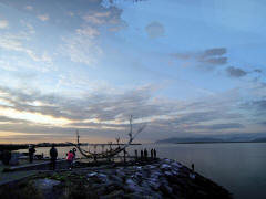
Leaving the lake, we drove back to the waterfront, passing the Harpa (Concert Hall and Conference Center, 2011), and turned down the coast road (Saebraut). We passed the Sun Voyager (1990), an interesting sculpture that looked to me like a stylized Viking boat. We also went by the former French Consulate building where Presidents Ronald Reagan and Mikhail Gorbachev held their summit meeting in 1986. As we drove, the guide described the geological features of Iceland, situated directly on the Mid-Atlantic Ridge where the Eurasian and North American tectonic plates meet. The friction between them created the many volcanoes that formed the island. This makes Iceland one of the most active volcanic regions on Earth. About a third of all the lava erupted since 1500 A.D. was in Iceland. On average, a volcano erupts about every 5 years. In the 20th century, eleven different volcanoes in Iceland erupted, many of them multiple times (e.g., Mt Hekla erupted four times). The friction between the plates also produces a great amount of heat below the surface. Iceland has done a great job of harnessing this heat both for heating purposes and to produce electricity. She gave as an example a large aluminum factory in nearby Straumsvik, built there to take advantage of the cheap geothermal electricity, even though the bauxite ore it processes comes all the way from Australia. Notwithstanding all this geothermal activity, that is not what gives Iceland its relatively mild climate. Rather it is the Gulf Stream that warms the waters around Iceland. As we looked out at the landscape, there was gray basalt (from lava) everywhere. Early on our ride through Reykjavik, I wrote in my notes that most of basalt was without vegetation. Hours later, as our bus traveled around the island, I found that wasn't the case. Eventually we saw plentiful trees, shrubs, grassy expanses, and flowers. We left the city and drove south on R42 down the Reykjanes Peninsula. We had been driving in very flat terrain, but shortly after 3:00 we turned onto a secondary road that took us into a stretch of low, barren hills. After a while, we stopped to see Kleifarvatn Lake, a long lake among the hills. It was formed as ground water filled craters left by the explosion of overheated ground water.
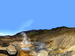
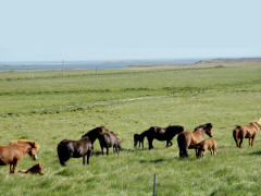
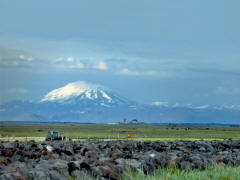
A few minutes later, we stopped again at the Krysuvík geothermal area, a series of boiling ponds and mud pits. The smell of sulfur was strong. Throughout the area, there were vents in the ground where steam steadily poured out. Back on the road, we soon turned east on R427 along Iceland's south coast. It was very desolate for the most part, miles of lava fields, not a tree in sight, very flat where we were driving, but with numerous small barren mountains in the distance. Of course the Atlantic was on our right. As we traveled east, we eventually began seeing signs of human habitation. There was an occasional farm in the distance, fields under cultivation, and fences, a sure sign of civilization. As we went on, we saw several groups of Icelandic horses grazing in the fields. (This is a distinct breed with no infusion from elsewhere for more than a thousand years.) Early in the drive on the coast road, we could see two snow-covered peaks in the far distance. The one on the left, the seemingly larger one (because it was closer), was Mt. Hekla (4,900 ft.), one of Iceland's most active volcanoes. The one on the right, near the coast, was the Myrdalsjokull, a huge icecap that covers the very dangerous volcano Katia. (Myrdalsjokull is immediately beyond Eyjafjallajokull, whose eruptions in April 2010 caused serious disruptions to air travel across western and northern Europe. We couldn't see Eyjafjallajokull, though, even though it was nearer, because its image did not stand out from that of the much larger Myrdalsjokull directly behind it.)
The
bus
got
to
our
destination
about
4:45.
We
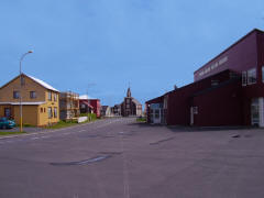
drove around Stokkseyr first,
although
it
was
past Eyarbakki. Both are described as typical 19th
century Icelandic fishing villages and appeared quite
similar. Some of the houses had plaques showing the date
of construction, ranging from 1850 to the early 1900s.
We didn’t realize until our guide pointed it out, but
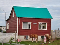
all the buildings had corrugated iron cladding to keep
out the Atlantic storms. The iron was painted, of
course, and from the bus looked very much like wooden
lap siding. We got to the restaurant in Eyarbakki at 5:00 for our meal. It included lobster tail, boiled potatoes, carrots, spicy couscous, and a dessert. The lobster tails were surprisingly small, about the size of a human finger. But they were good, and there were plenty of them. The whole meal was served family-style, and the serving dishes were replenished promptly. For my part, I was disappointed with the visit to the villages. After the long drive to get there, we drove almost directly to the restaurant, so we didn't see that much of the villages. What we did see was not very "quaint." Incidentally, Litla-Hraun, the largest and most notorious prison in Iceland, is located just outside Eyarbakki. After we left Eyarbakki at about 6:00, our guide called our attention to a small island in the Atlantic to the south. This was Surtsey, formed by volcanic eruptions (1963-1967). It got to be about a square mile in size but has been eroding since the eruptions stopped. There are many such islands around Iceland, and most of them eventually are swallowed up by the sea.
The bus
took a different, more populated route back to Reykjavik, taking us north
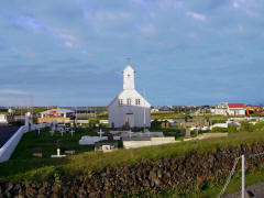
through Selfoss with its suspension bridge over the
Olfusa River. The pretty white church by the bridge must
be the most photographed building in the area. Bobby
Fischer, the former chess champion, is buried there, and
his grave has become something of a tourist attraction.
Heading northwest on R1, we passed a couple geothermal area within sight of the road. We soon started seeing increasingly more vegetation until eventually there were whole forests. Back in the city, we saw the Hallgrim Memorial Church (1986), the largest church in Iceland. Although construction began in 1945, it took 38 years to complete the church.
Copyright © 2000-2023 DarrellPeck.com All rights
reserved. | |||||||||

